Where is Ogliastra? Map, Beaches and How to Get There
Discover where Ogliastra is located, the road and beach map, and all practical directions to reach eastern Sardinia from ports and airports.
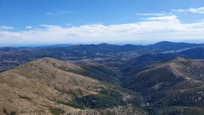
Ogliastra is one of the most fascinating historical and geographical regions of Sardinia, located along the center-eastern coast of the island. Often defined as "an island within an island" due to its partial geographical isolation caused by the Gennargentu mountains that surround it to the west, Ogliastra is renowned for the extraordinary variety of its landscapes, ranging from mountain peaks to white sand beaches and pristine coves.
In this guide we will see exactly where Ogliastra is located, how it is structured geographically, and all the useful directions to reach it from the main arrival hubs in Sardinia.
Where is Ogliastra: Geographical Overview
Ogliastra extends from the Gennargentu massif to the Tyrrhenian Sea. It borders to the north with the historical regions of Baronie and Nuorese (specifically the Barbagia di Ollolai), to the west with the Barbagia di Seulo, and to the south with Sarrabus-Gerrei.
Its natural borders are clearly outlined:
- To the North: The valley of the Codula di Luna river and the southern slopes of the Supramonte.
- To the West: The high peaks of Gennargentu (including the Punta La Marmora massif).
- To the South: The Quirra massif.
- To the East: A spectacular coast washed by the Tyrrhenian Sea, rich in monumental cliffs and sandy beaches.
Administratively, the territory is now part of the Province of Nuoro (after being an autonomous province until 2016 with the capitals Tortolì and Lanusei). Tortolì is the most populous and commercial center, while Lanusei rises in the mountainous hinterland.
The Map of Ogliastra: From the Coast to the Inland
The geography of Ogliastra can be ideally divided into three bands:
1. The Coast: It extends for over 80 kilometers. The northern part (the Baunei coast) is characterized by limestone cliffs overlooking the sea and spectacular coves accessible only on foot or by boat. The central and southern part (from Arbatax to Tertenia) features wide beaches of fine sand or pebbles (such as Lido di Orrì, Cea, Marina di Gairo, Coccorrocci).
2. The Hills and the Tacchi: Right behind the coast, the land rises rapidly towards hills covered with Mediterranean scrub, Cannonau vineyards, and spectacular limestone formations known as "Tacchi" (such as the Tacco of Jerzu or Ulassai).
3. The Mountains: The highest villages (such as Talana, Villagrande Strisaili, Arzana) rise on the slopes of Gennargentu, immersed in dense forests of holm oaks and cork oaks.
How to Get to Ogliastra from Cagliari
Cagliari represents the most common and convenient arrival point for those heading to Ogliastra, especially thanks to the presence of the port and the Cagliari-Elmas airport.
- By Car (SS 125 Var): The fastest solution is the new Strada Statale 125 Orientale Sarda (SS 125 Var), a high-speed highway that connects Cagliari to Tortolì in about 1 hour and 45 minutes (approx. 140 km). The road is modern, safe, and avoids the old curves of the Campuomu pass.
- By Bus: The regional company ARST operates daily connections from the Cagliari bus station (Piazza Matteotti) to Tortolì and the other villages of Ogliastra. The travel time varies between 2.5 and 3 hours depending on the route.
How to Get to Ogliastra from Olbia
For those landing in Olbia (Olbia-Costa Smeralda airport or port of Olbia Isola Bianca), the journey towards Ogliastra offers beautiful mountain or coastal scenery.
- By Car (SS 131 DCN + SS 389 var): The fastest route involves taking the SS 131 DCN towards Nuoro, then turning onto the SS 389 var (Nuoro-Lanusei) towards Ogliastra/Tortolì. The travel time is about 2 hours and 15 minutes (approx. 180 km).
- By Car (SS 125 - Scenic Route): For those who prefer a scenic journey and are not in a hurry, it is possible to travel the entire SS 125 Orientale Sarda southwards. You will cross Siniscola, Dorgali, and the suggestive Genna Silana pass in the Supramonte. This journey takes about 3 hours, but offers breathtaking views of the Gorropu canyon and the Supramonte mountains.
How to Get to Ogliastra from Alghero / Porto Torres
If you arrive in the north-western part of Sardinia (Alghero-Fertilia airport or port of Porto Torres), Ogliastra is about 220-250 km away.
- By Car from Porto Torres: Take the SS 131 (Carlo Felice) southwards to Macomer, turn onto the SS 129 towards Nuoro, and finally take the SS 389 var towards Lanusei/Tortolì. The estimated time is about 2 hours and 45 minutes.
- By Car from Alghero: Take the state road towards Sassari/Porto Torres, enter the SS 131 and follow the same itinerary described above. The travel time is about 3 hours.
Road Map and Useful Tips
Getting around Ogliastra is a unique experience, but it requires attention:
- Car Rental: It is highly recommended to rent a car upon arrival at the airport. Moving between the small inland villages or reaching the most isolated beaches solely by public transport can be extremely limiting.
- Mountain Roads: The roads connecting the coast to the mountain villages (such as Jerzu, Ulassai, Baunei, Talana) are full of curves and steep slopes. Drive carefully and enjoy the landscape.
- Service Stations: Along the SS 125 Var highway, fuel stations are rare. Make sure to refuel in the main centers like Tortolì, Lanusei, or Bari Sardo before embarking on long journeys.